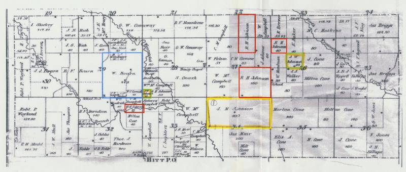
Scotland County Missouri Land Plat Map from 1876 showing:
1) Section 34 - Jacob Marmon Johnson 400 acres
2) Section 26 & 28 - Alva Washington Johnson 50 acres
3) Section 26, 27 & 28 - R. H. Johnson (brother of Alva) 310 acres
4) Section 29 & 30 - William Bourn, B. F. Bourn and J. J. Bourn