James Shelton images
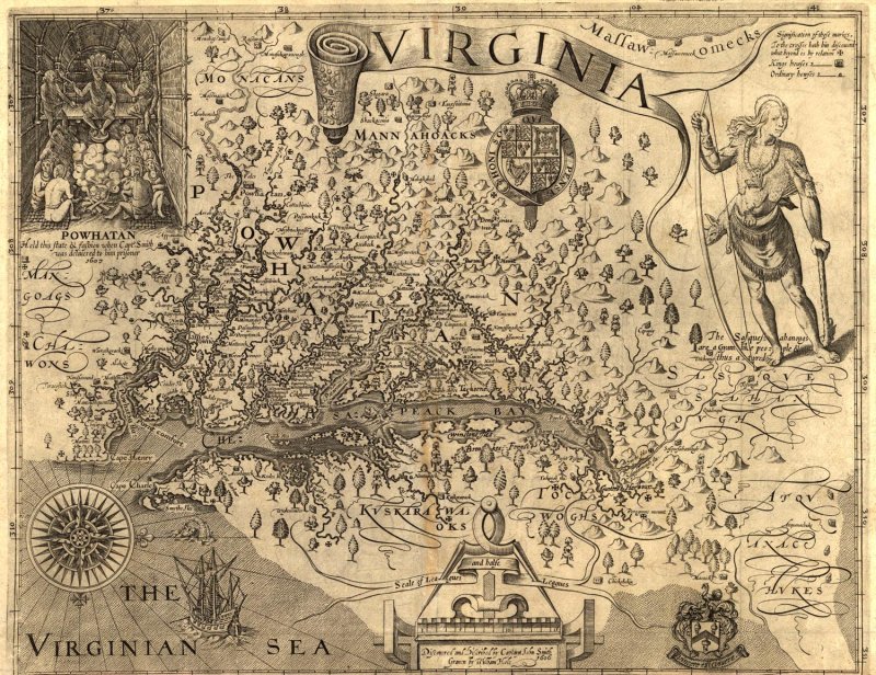
"This is an original map created in 1624 in London. The map shows Virginia, as described by Captain Smith in the year 1606. The map shows incredible details of the region, including settlements, terrain, and the location of Indians. Also, it includes a fascinating inset illustration of the famous Indian King, Powhatan. It includes a portrait of another Indian as well."
Source: http://www.sonofthesouth.net/revolutionary-war/maps/captain-smith-virginia-map.htm
Source: http://www.sonofthesouth.net/revolutionary-war/maps/captain-smith-virginia-map.htm
