
Henry Frakes's Land
In October of 1814, Cuthbert and Anna Harrison sold six acres of land to Wilford Lee. The land lay on the Bullitt County side of the Rolling Fork River. Beyond that, the only clue as to its location was that it was "opposite Frakes Ferry."
We learn from an early survey that one Henry Frakes was living on the Hardin County side of Rolling Fork River in November 1797. The survey text is transcribed below. We have attempted to transcribe it without altering its spellings.
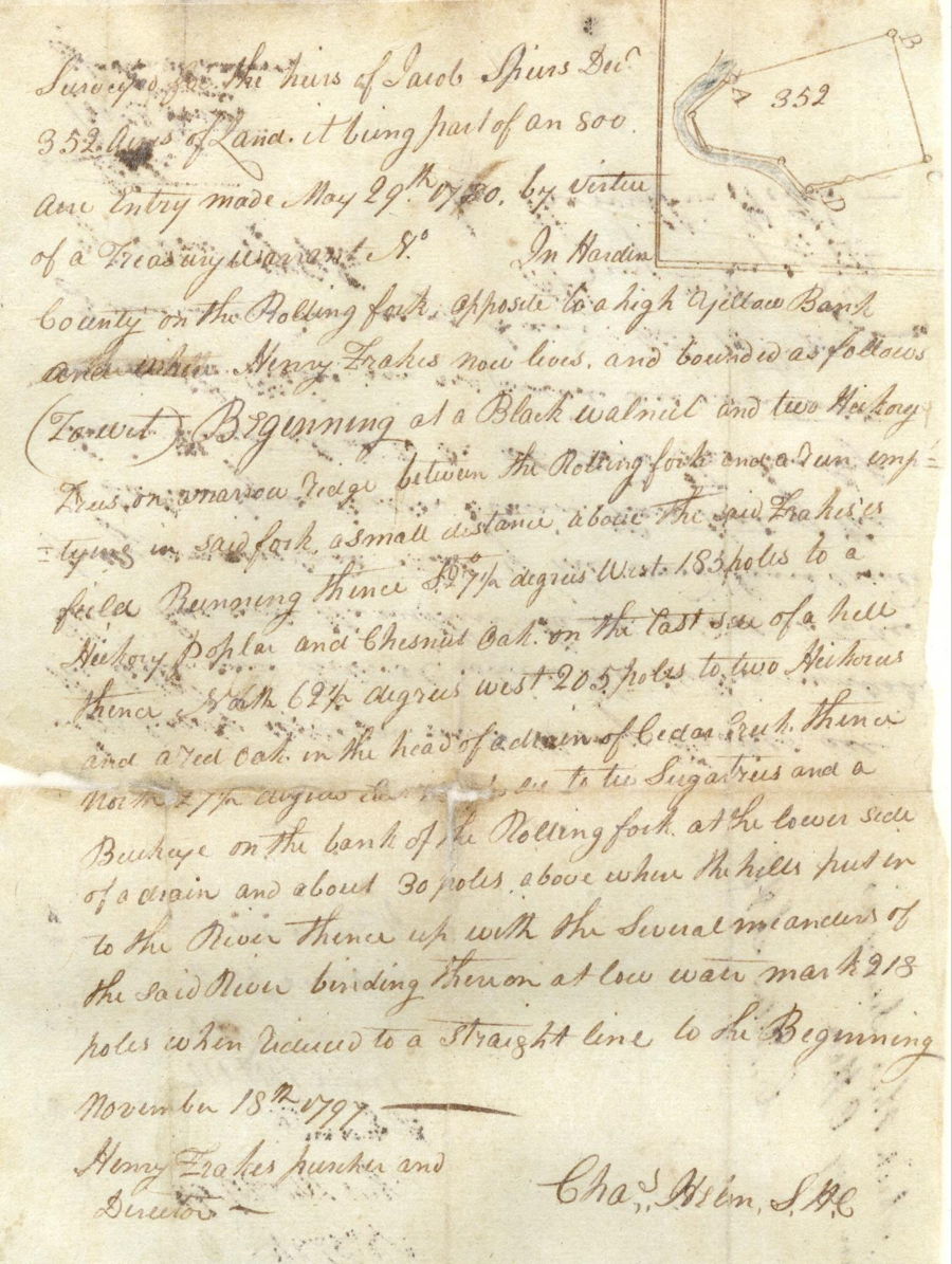
"Surveyed for the heirs of Jacob Spears, Decd, 352 acres of land, it being part of an 800 acre entry made May 29th 1780 by virtue of a treasury warrant No. ___ in Hardin County on the Rolling Fork opposite to a high yellow bank and where Henry Frakes now lives, and bounded as follows (to wit) Beginning at a black walnut and two hickory trees on a narrow ledge between the Rolling Fork and a run emptying in said fork, a small distance above the said Frakes's field, running thence S 27 1/2 degrees West 185 poles to a hickory, poplar and chesnut oat on the East side of a hill, thence North 69 1/2 degrees West 205 poles to two hickories and a red oak in the head of a drain of Cedar Creek, thence North 27 1/2 degrees East [tear in paper] poles to two sugar trees and a buckeye on the bank of the Rolling Fork at the lower side of a drain and about 30 poles above where the hills put in to the river, thence up with the several meanders of the said river, binding thereon at low water mark 218 poles when reduced to a straight line to the beginning. November 18th 1797. (signed) Henry Frakes, purcher and director; Chas Helm S.H.C."
An image of this survey is shown below.
In 1804 a deed referencing this survey was issued to "Alexander Frakes, heir of Henry Frakes." It appears that the earlier owners had assigned the land to Henry Frakes following the 1797 survey.
The deed copies within it the location of the tract as quoted from the earlier survey, with the exception that the number of poles lost due to the tear in the original survey has been written in as 185 poles, matching the length of the first line. We believe this is not accurate.
Below are two images. The left one is taken from the survey itself; the right one is a drawing of the first three lines of the plot, shown with north at the top.
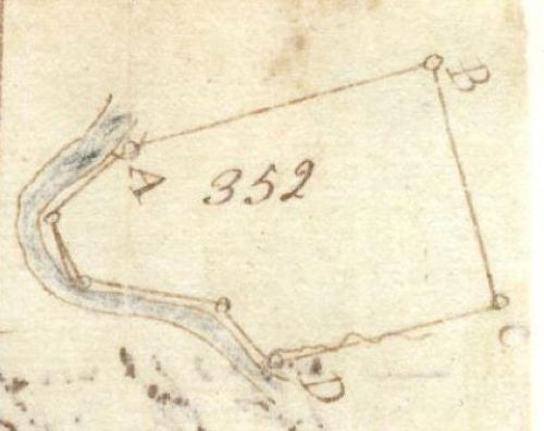
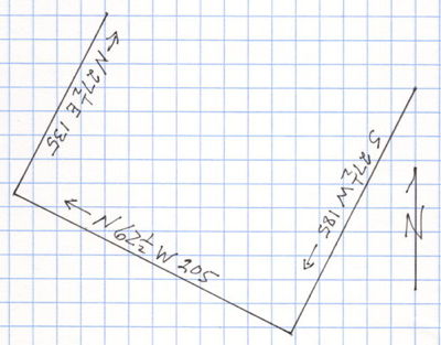
You will notice that in each one, one of the legs is drawn longer than the other. From actually measuring the length of the lines on the survey drawing and doing a bit of calculating, we think the third line, the one missing on the survey, should be 135 poles instead of 185 poles. It is easy enough to see how the 3 could be mistaken for an 8, even before the paper was torn.
Using these figures, we have attempted to plot these lines on a Google map, and within rough measurements, you can see on the map below that we seem to have located the approximate location of this tract [A on the map]. And if we are right in our calculations, then we now know where Wilford Lee's six acre tract is located, just across the river.